Located in Minas Gerais, the iron ore & phosphate mining powerhouse of Brazil, 350km from the state capital, Belo Horizonte.
10 Mineral Concessions totalling 152 km2 covering 70km of the NE trending Tiros sedimentary sequence.
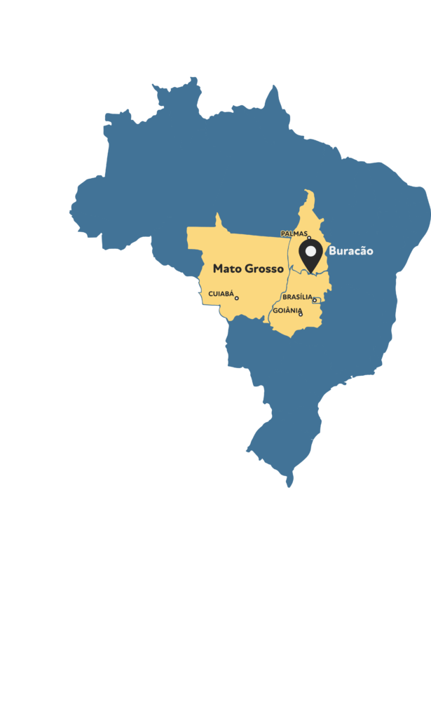

The Buracão gold project located at the border of the states of Tocantins and Goiás in central Brazil. It is approximately 40 km northeast from the city of Minaçu, Goias. Minaçu is a Brazilian municipality in the State of Goiás and is located at latitude 13°31’58” South, longitude 48°13’12” West with an altitude of 350 meters. Minaçu has an estimated population in 2020 of 28,793 inhabitants (IBGE 2020).
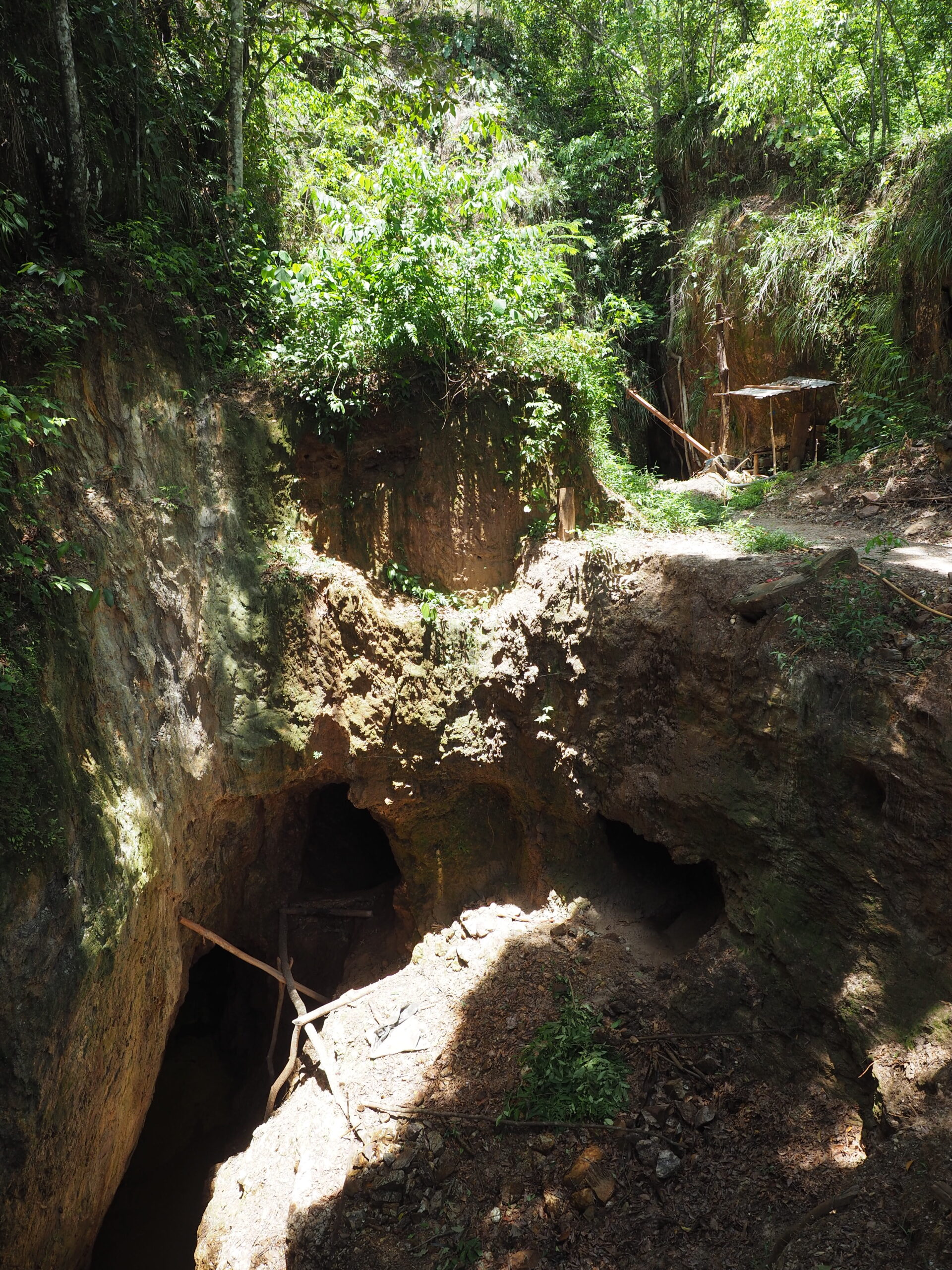
The Buracão project involves two neighbouring ANM mineral processes: number 864466/2008 and 864508/2010. These licences are situated on a farm property owned by the family from whom Resouro acquired the rights from. The property comprises a total area of 3995.28 hectares and represents an advanced-stage exploration property
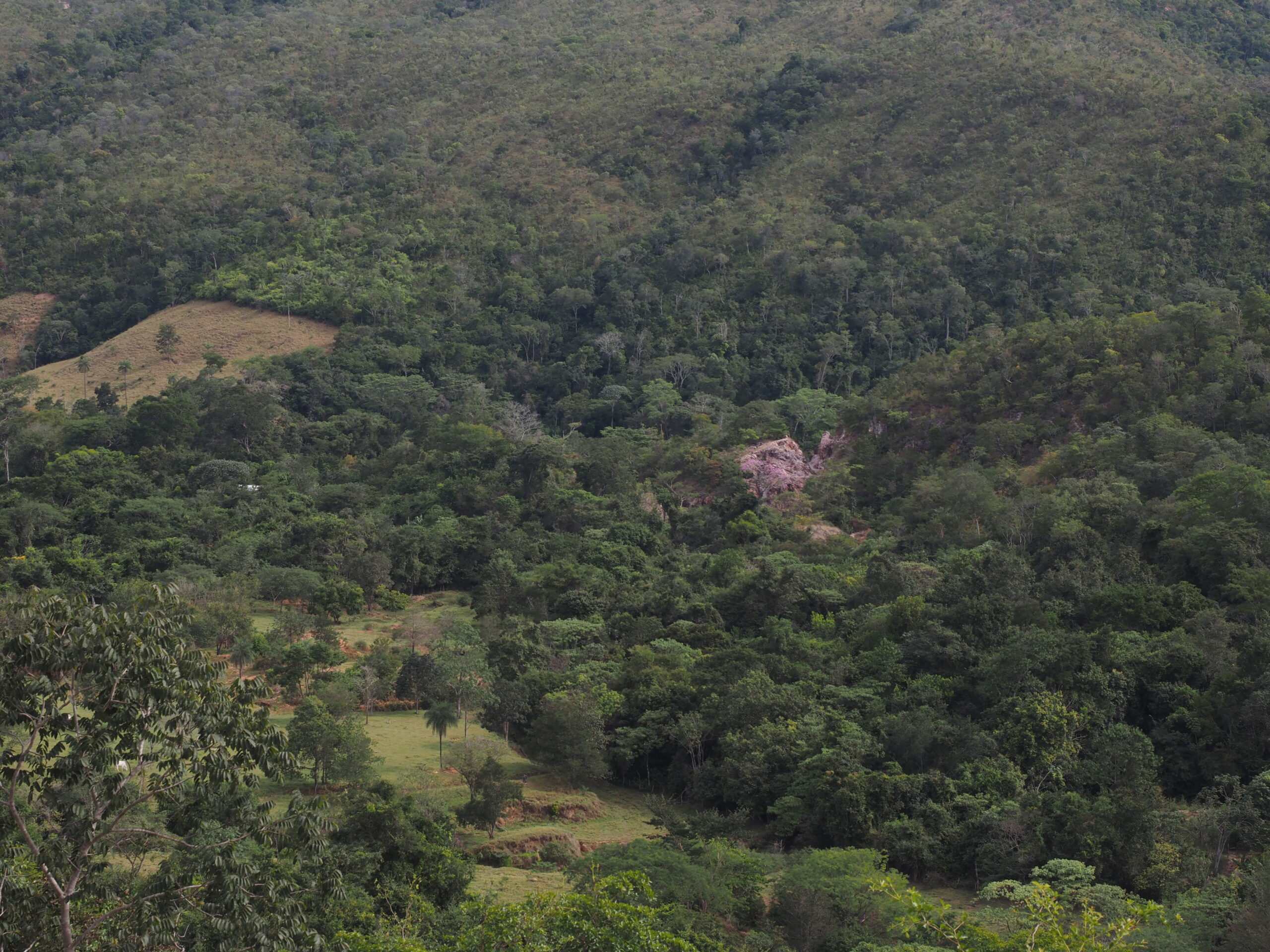
The climate is seasonal tropical and characterised by high humidity with temperatures ranging from 18°- 36°C. The average annual rainfall is 1,600mm, mostly between November and March (Figure 5‑2). Savannah vegetation or “cerrado” is typical of the region, with riverbanks typically covered by thick vegetation known locally as “mata ciliar” or “eyebrow forest”. Exploration at Buracão can be completed year-round with some additional challenges during the rainy season.
The area is approximately 400 kms from Brazil’s capital city, Brasilia. The closest town is Minaçu 55 km away that sites on the shores of the artificial lake Cana Brava, created after a dam was constructed on the Tocantins River. Minaçu means ‘Big Mine’ in the tupi-guaraní Language and reflects the presence of one of the world’s largest chrysotile mines that bounds the city’s western extent. The Cana Brava mine, located on the banks of the Tocantins River, occupies a total area of 45 km2 . Chrysotile production has made Minaçu one of the richest municipalities in the state of Goiás.
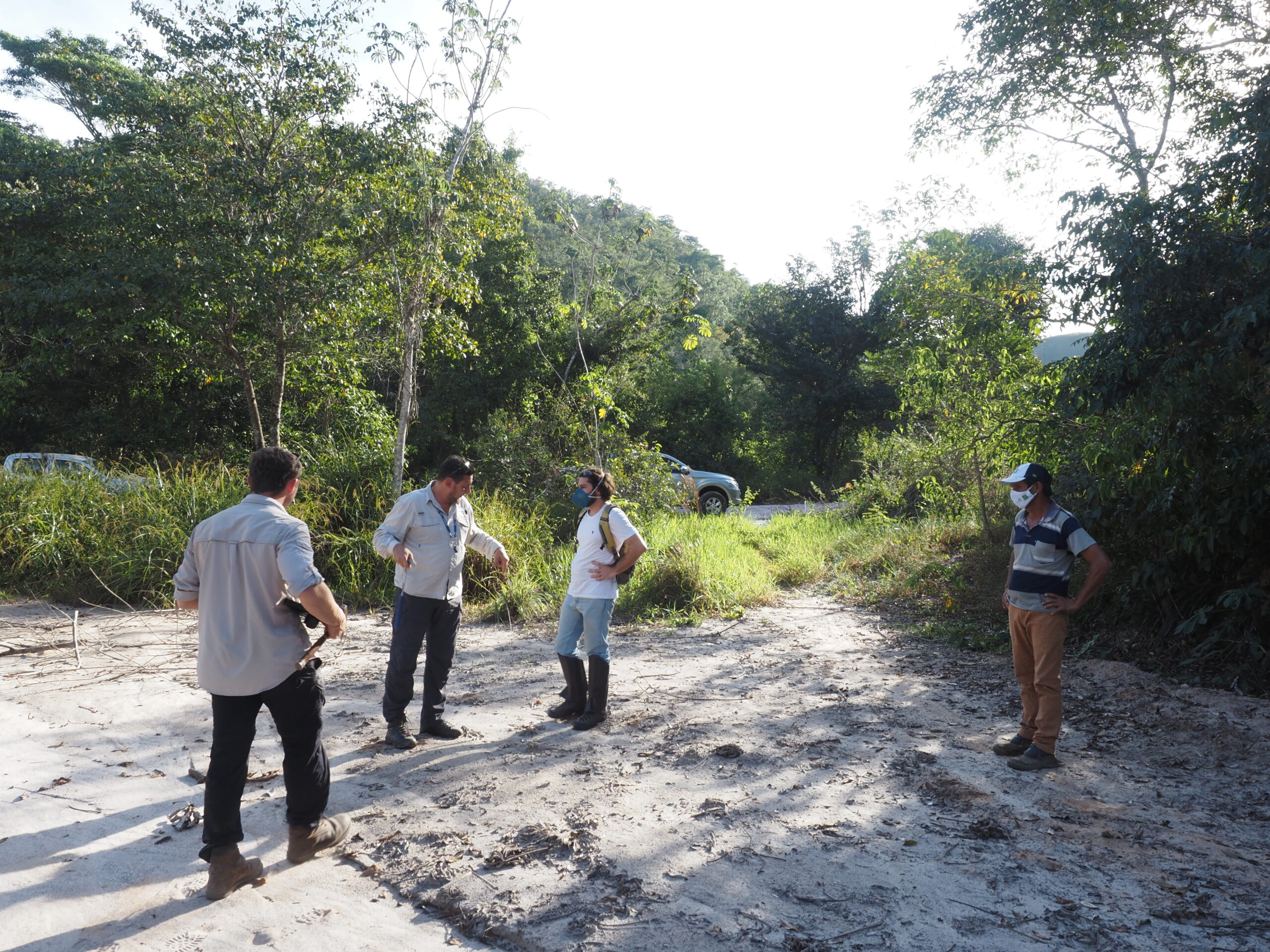
The city of Minacu is the closest population centre and is equipped with all the local amenities such as banks, hospitals, hotels, and supermarkets. In addition, the long history of mining in the town has provided the area with a skilled workforce experienced in disciplines that support mining such as machinery mechanics and general maintenance.
The area has a hydroelectric power plant operated by Tractebel-Engie with an installed capacity of 450 MW, and a physical guarantee of 260.8 average MW. The plant has been in reliable operation since 2002. Currently, no mains power exists at the property, but a diesel generator supplies the field camp with electricity. Diesel is transported to the site by trucks and stored in tanks.
Surface water is plentiful in the area with portable pumps capable of providing sufficient water for exploration activities such as drilling. Drinking water is provided by a water well with an above ground water storage facility already constructed. Minor improvements are required to ensure the quality of the water.
A core shed, kitchen, recreation area, gym, dormitory, toilet/showers, and storage buildings were constructed by past operators and remain in fair condition.
The Buracão Gold Project is located within the Proterozoic Brasília Fold Belt (BFB), which stretches from Araxa in the south to Porto Nacional in the north. This province results from the Brasiliano-Pan African Orogeny involving the collision between the Amazon and São Francisco cratons and the Parana Block of central Brazil. The Buracão project is positioned within the external domain of the northern sector of the BFB at the border of Tocantins and Goiás States. Crustal shortening in this region led to a deep-seated fold-thrust belt developing involving the entire lithological sequence down to the basement.
In the northern sector of the belt where the project is situated, the key lithologies of the external domain are the metasedimentary rocks of the Arai (Paleoproterozoic) and Paranoa (Mesoproterozoic) Groups. In the southern extension of the belt, below Brasilia, the belt also includes the metasedimentary units of the Canastra Group. Together, these three groups host significant gold mineralisation, including the Morro do Ouro/Paracatu (Kinross Gold Corporation). At Buracão, the main area of mineralisation is positioned at the contact between the Arai and Paranoa groups.
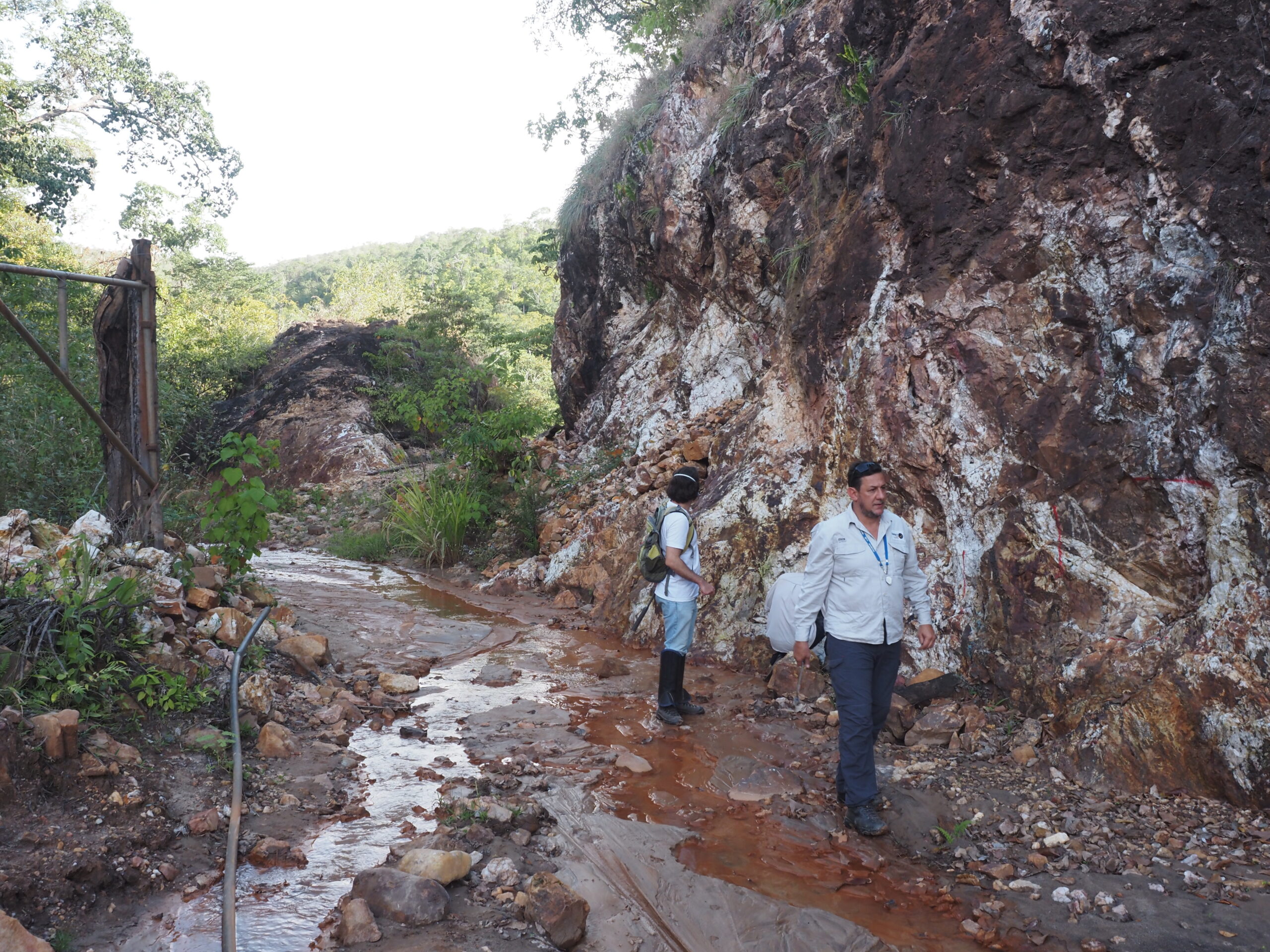
The gold mineralization in the Buracão Project is related to orogenic quartz veins with sericite hydrothermal alteration in metasedimentary rocks (phyllites and quartzites) of the Araí Group, with a polyphase structural evolution and major structural control associated with the Brasilian Fold Belt.
Previous explorers have focused on the geological model that suggests there are three main NNE-trending mineralised zones. An alternative view that Resouro believes deserves further consideration is that the system is part of a 1500m wide riedel shear corridor with the mineralised structures being related dilational zones associated synthetic or antithetic features.
Resouro believes the previous exploration on the property failed to define a large resource base because there is a strong and complex structural control on the mineralisation that has not been full understood yet. Resouro’s short term aim is to use the companies expertise in structural geology to develop a detailed structural model that will provide the basis for a drilling programme.
Along side the technical work on the structural component, Resouro will appraise the potential of historical tailings that the company believes could be a route to early cashflow.
Using the structural model and results from the initial drilling campaign, the company is aiming to define a resource in excess of 500 koz across the licence. Successful exploration in the licence area also presents discovery potential.
There has been intermittent historical exploration work undertaken at the property over the last several decades. Most of this work has been concentrated on the exploration license 866.035/2009 (930,35 ha) and carried out by RJK Resources (RJK), Rio Tinto Zinco (RTZ), Graben Mineração SA (GMS) and Nexa Resources (NEXA).
The works have consisted of terrestrial geophysics, airborne geophysics, geochemistry and exploratory drilling. Resouro has compiled as much as this information as possible and is using it to plan the next phase of modern and intelligently led exploration.